A Reproduction Nautical Chart of Boston Harbor by U.S. Coast and Geodetic Survey originally published in 1979. The original size of the chart is 44″ wide by 34″ tall.

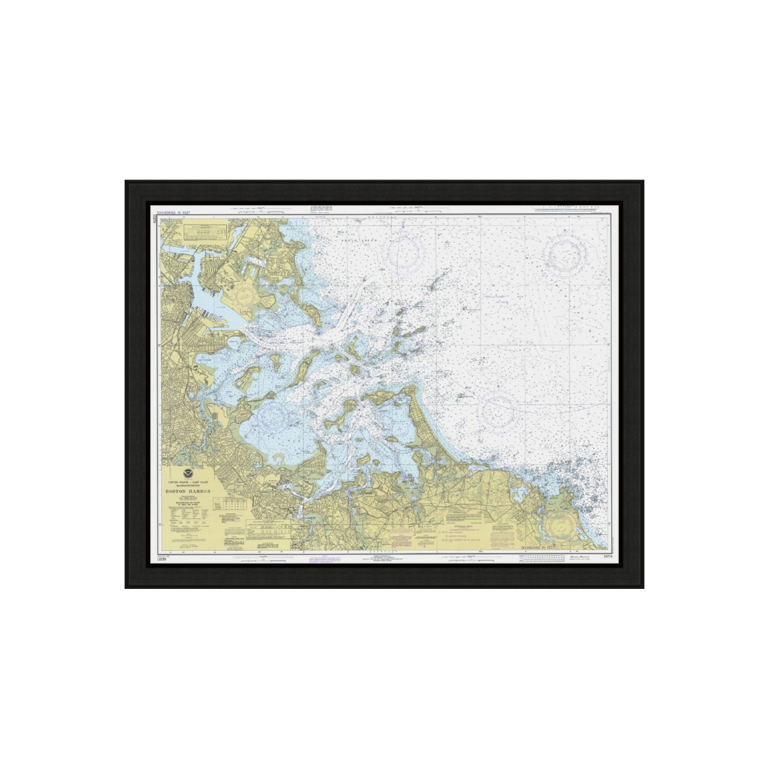

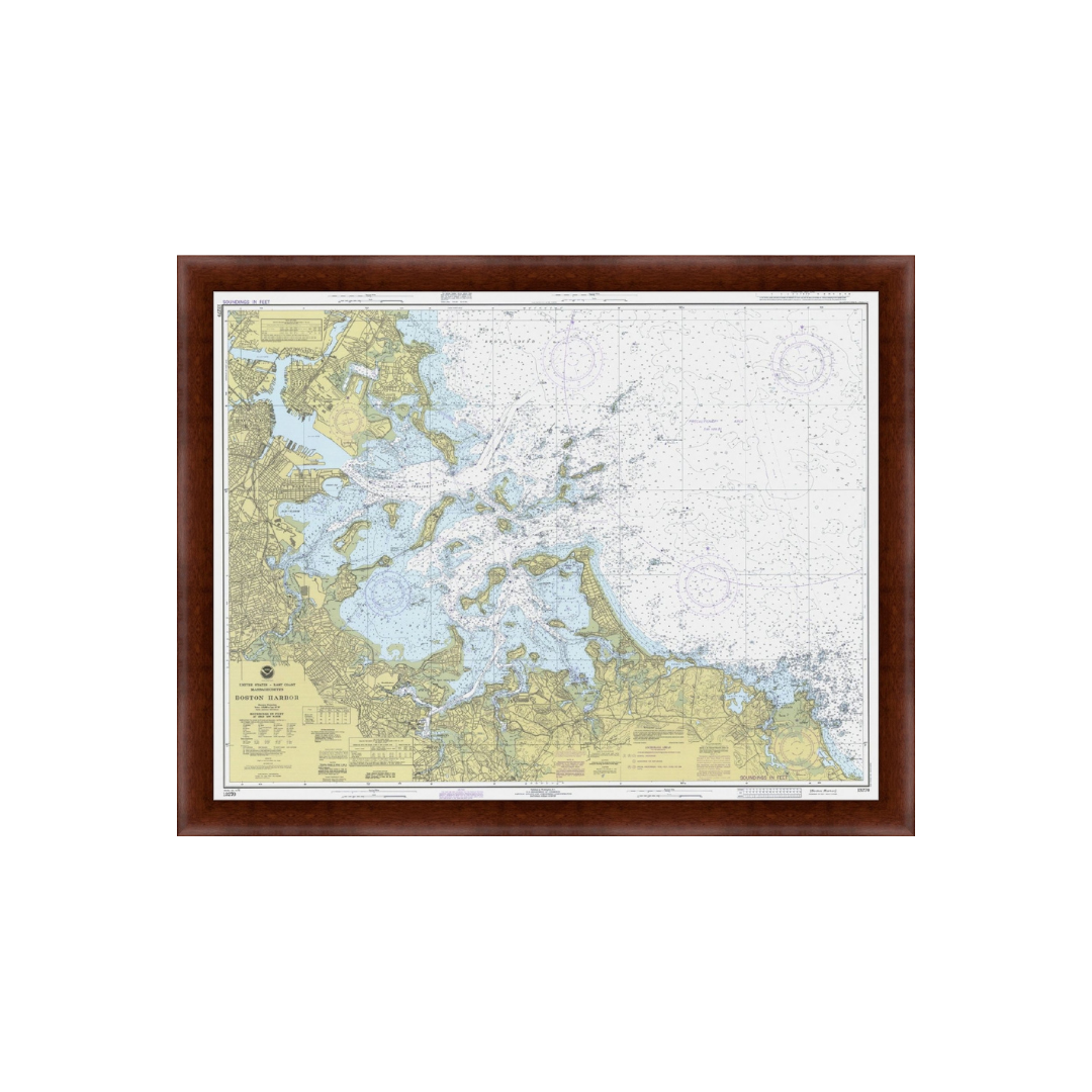
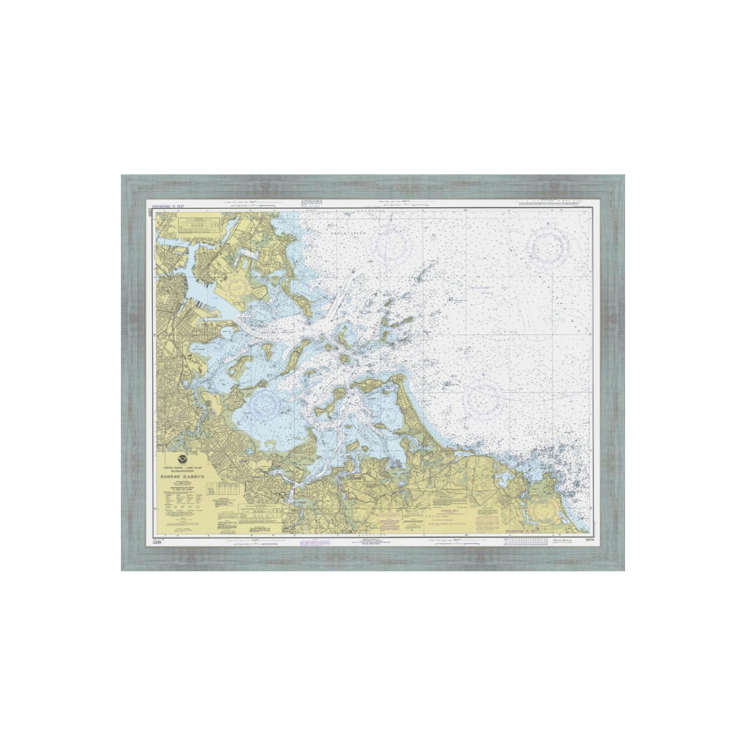
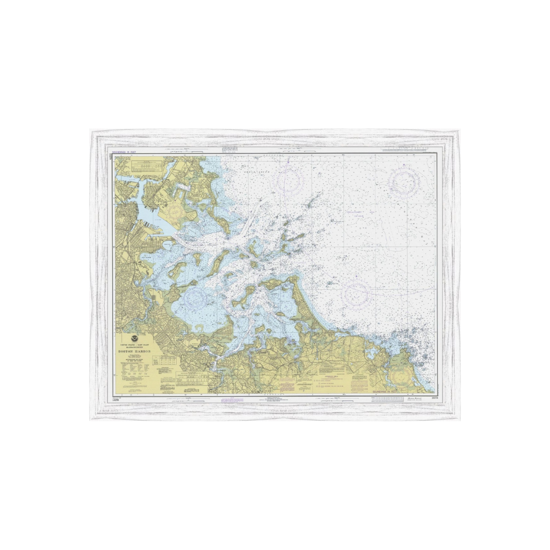
BOSTON HARBOR, MA 1979 Nautical Chart
Pickup Only: This product is available for Local Pickup only.
Price range: $30.00 through $165.00
Map Size: 28×22 in
| Framing Options | Unframed, Rustic Black, Rustic White, Rustic Blue, Black, Walnut |
|---|